Creation of an interactive map of land plots and utilities in the cities of Ust-Kamenogorsk and Semey
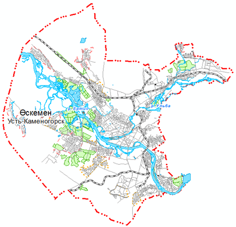
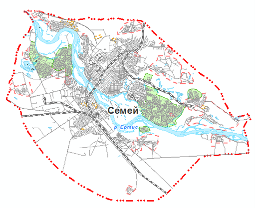
The interactive map was formed by integrating and processing the source data. The basis was electronic open access maps for the cities of Ust-Kamenogorsk and Semey (RSE "NKGF" RK). Additionally, archival topographic and geodetic materials from previous years were used, including diagrams and plans of various scales that have undergone vectorization.
The processing of the collected materials and the creation of a unified digital terrain model were carried out in a geoinformation environment. The ArcGIS Desktop 10.2.1 software was used as the main toolkit for updating the digital cartographic basis of cities.
During the work on updating the electronic maps of Ust-Kamenogorsk and Semey, the spatial position of the terrain objects was clarified, as well as their attribute data was updated. Based on information from the address register of cities, the actual names of urban planning elements, numbers, number of floors and types of buildings and structures were plotted on the map. The complex of measures taken made it possible to ensure high accuracy and reliability of data for open access users.
The data of urban planning regulations (master plan and DPP), information on vacant land plots from the AIS GZK, as well as layers of engineering networks and communications were also integrated into the formed digital basis. All materials are pre-arranged in the required format. The final results of creating interactive maps of cities are shown in Figures 1 and 2.
Back to all projects