Creation of a geoportal of the East Kazakhstan region based on interactive city maps
As part of the work on the development of the geoinformation infrastructure of the East Kazakhstan region, the staff of Geoinfo LLP developed a regional version of the East Kazakhstan Region geoportal on a scale of 1:100 000. The main objective of the project was the integration of existing geoportals of cities and towns in the region into a single system with the unification of spatial and attribute data and bringing them in line with the requirements for geoportals of local executive bodies.
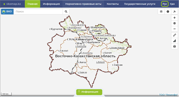
Access to the geoportal is implemented through a web interface that ensures the openness of information and the provision of services to an unlimited number of Internet users. The interface is clear and intuitive, and the logical structure of the resource allows you to quickly switch between sections and pages (Figure 1). The content of the geoportal is presented in the official and Russian languages. The access rights differentiation system provides users with the opportunity to work with functionality in accordance with their security clearance level.
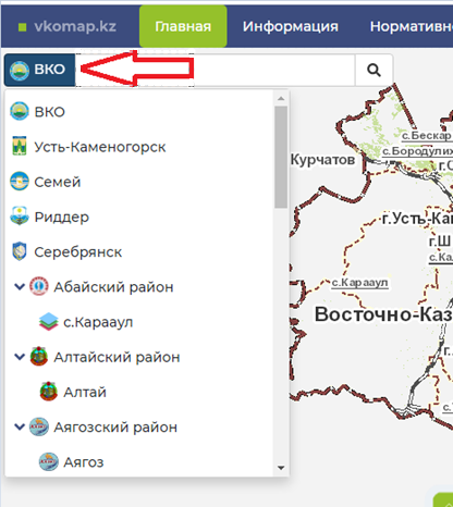
By default, a 1:100 000 scale map of the East Kazakhstan region is displayed on the main page of the geoportal. The transition to detailed plans of settlements (up to a scale of 1:2 000) is carried out automatically when approaching (zooming) to the desired location, either by selecting an object from the list or using the search tool (Figure 2).
The regional version of the geoportal has been developed taking into account the functional compatibility with previously created geoportals of settlements. The use of identical and compatible software codes and components has avoided the need to install additional software for database management systems. The technology of pre-generated tile images is used to display graphic and attribute information. This approach makes it possible to significantly increase the data download speed, reduce bandwidth requirements for communication channels, and optimize the use of system resources.
Throughout the entire period of operation of the East Kazakhstan Region geoportal, users are provided with continuous consulting support on issues related to working with system components.
Back to all projects